Eden Isle Saw Tree And Home Damage, While Street Flooding And Utility Problems Hit Other Parts Of The City
Slidell was hit on multiple fronts as the remnants of Arthur moved across southeast Louisiana, bringing street flooding, wind damage, power outages and continued high water concerns beyond the storm itself. In Eden Isle, crews and residents spent Friday clearing limbs and checking damaged property after strong winds tore through the neighborhood. Elsewhere across Slidell, residents dealt with flooded streets, difficult travel conditions and outages that stretched into the night.
Before the worst weather arrived, the City of Slidell warned residents that repeated rounds of storms from Tuesday through Friday could bring heavy rain and flash flooding. The city said most areas could receive 3 to 6 inches of rain by Friday, with some locations seeing much higher totals if storms repeatedly tracked over the same area. The city also opened a temporary self-service sandbag distribution site near Heritage Park on June 17 ahead of the expected rainfall.
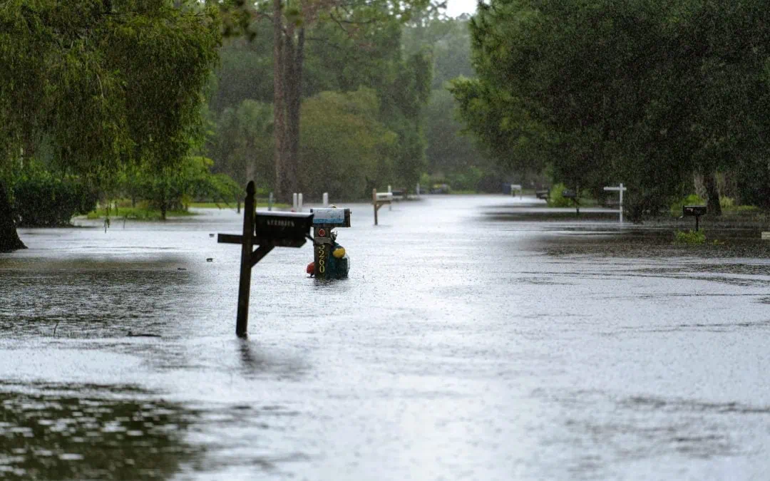
As the storm moved through, flooding became one of the broadest impacts in Slidell. City officials had already warned that roads could quickly become hazardous in low-lying areas, and Cleco later said flooded roadways were complicating restoration work in places including Slidell. The utility said some customers in Slidell would remain without power overnight as crews worked around downed trees, broken poles and power lines damaged by high winds, lightning and flooding.
The most visible wind damage was reported in Eden Isle, where the National Weather Service surveyed the area after Thursday’s storms. In its public statement, the weather service said Eden Isle was extensively surveyed, with widespread branches down on almost every street and scattered minor home damage. The agency said it would hold the Eden Isle damage as wind damage, not a confirmed tornado.
The survey followed an earlier Friday notice from the weather service that crews would inspect storm damage near Slidell in St. Tammany Parish after severe thunderstorms moved through on June 18. That early notice said preliminary findings could be available by the end of the business day, with a fuller assessment to follow in a later public information statement.
Arthur’s local impact also outlasted the heaviest rain. As of Friday morning, National Weather Service flood products tied to Slidell showed continued flood warnings for the Pearl River near Pearl River, as well as minor flooding warnings for river points near Covington. Those alerts underscored that even as neighborhood cleanup began in Slidell, water problems were still being monitored across St. Tammany Parish.
For Slidell residents, it was a citywide weather event that affected access, utilities, cleanup and recovery across multiple neighborhoods. In a city where heavy rain can quickly back up drainage systems and leave low-lying streets impassable, the combination of wind damage, flooded roads and lingering river warnings created a broader recovery picture than a single tornado question alone.
Why This Matters In Slidell
This storm affected more than one neighborhood. Eden Isle drew attention because of visible wind damage, but the broader Slidell story included flood-prone streets, storm prep measures, power outages and lingering river concerns that can affect travel, property and cleanup well after the rain ends. For residents across the city, that wider impact is what determines how quickly daily life returns to normal.
Sources
- National Weather Service Public Information Statement
- City Of Slidell Weather Alert, June 16, 2026
- City Of Slidell Sandbag Distribution Announcement
- Cleco Storm Center
- Cleco Power Restoration Update
- National Weather Service Advisories For Slidell
- National Weather Service Flood Information For St. Tammany River Points

Piper specializes in crafting compelling narratives for local businesses throughout the unique landscape of Louisiana and beyond.